Where to watch the fall salmon run in Ontario
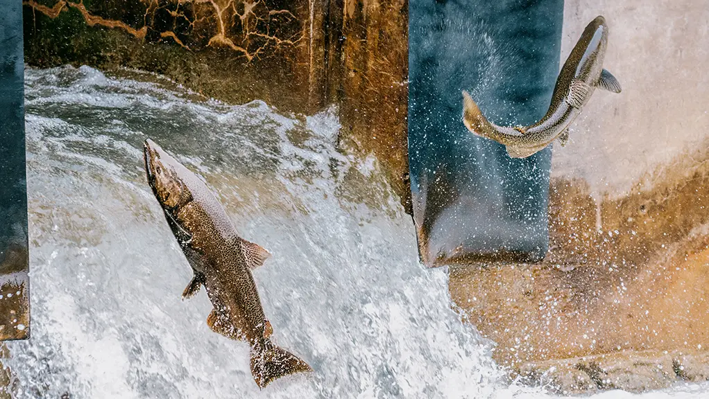
Port Hope | Port Hope Tourism
As thousands of salmon migrate from the Great Lakes and swim up rivers and creeks to spawn, hundreds of photographers and onlookers flock to watch them.
In Ontario, the annual autumn salmon run primarily peaks from mid-September to mid-October. Here are some of the best spots across the province to witness this spectacular natural migration.
Kawarthas and Northumberland
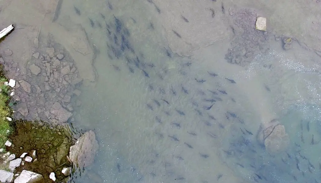
Just over an hour’s drive east of Toronto, the Kawarthas and Northumberland County offer a variety of ways to enjoy the fall season, from fall colour driving routes to the famous butter tart tour. It’s also home to one of Ontario’s most popular spots to catch the annual salmon run.
Ganaraska River, Port Hope
The Ganaraska River is home to one of the most extensive salmon runs in Southern Ontario and downtown Port Hope is a wildly popular viewing location. It’s so popular that the town celebrates the seasonal event during the Run Salmon Run festival.
One of the best viewing spots is from Corbett’s Dam, where the Ganaraska Fishway, better known as the fish ladder, helps thousands of Chinook and coho salmon past the barrier while an underwater camera streams the migration. From there, riverside paths such as the Waterfront Trail and the Ganaraska Hiking Trail follow the fish through town past shallow rapids.
While salmon migration depends on rainfall and temperatures, it typically occurs from late August to early October. A seasonal fishing sanctuary protects much of the river from early September to mid-October, so plan to watch rather than catch fish.
Location: Corbett’s Dam, 4 McKibbon Street, Port Hope
Greater Toronto Area
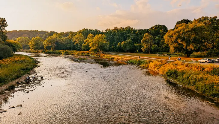
The diverse neighbourhoods and communities across Toronto, North York, Scarborough and Mississauga make up Ontario’s most populous region. The area is also home to an extensive network of waterways that supports seasonal wildlife, including autumn fish migrations. Lake Ontario is connected to the GTA by a dense hydrological system of rivers, streams and tributaries that feed into the lake.
The Toronto and Region Conservation Authority (TRCA) conserves and manages land and water across the GTA and beyond. It protects natural areas, improves water quality and supports habitat stewardship and monitoring that help sustain the ecological conditions migrating fish need as they move through river and tributary corridors in the fall.
Humber River, Toronto and Etobicoke
The Humber River is the largest watershed in Toronto and one of the most reliable places in the Greater Toronto Area to watch the fall salmon run.
From late September to mid-October, Chinook salmon push upstream from Lake Ontario and leap the weir at the Old Mill Dam, a jump of about a metre and a half that draws steady crowds to Étienne Brûlé Park.
A short distance upstream, a fish ladder built by the TRCA at Raymore Park lets you follow the fish past a second barrier. Viewing opportunities are best after a good rain, once the water clears.
Get tickets for the Salmon Walk at Étienne Brûlé Park on Saturday, October 17, 2026.
Locations:
- Old Mill Dam, 10 Catherine Street, York
- Raymore Park, 93 Raymore Drive, Etobicoke
Highland Creek and Rouge River, Scarborough
Scarborough’s east-end valleys give salmon watchers two rivers within a short drive from each other.
Along Highland Creek, the Highland Creek Trail links a chain of parks, from Morningside Park upstream to Colonel Danforth Park and Lower Highland Creek Park, where Chinook salmon rest and run in the shallow rapids.
The TRCA Adventures of Salmon is a free, family-friendly day of discovery at Morningside Park on October 4, 2026.
A little farther east, the Rouge River and Little Rouge Creek carry strong numbers of fish through Rouge National Urban Park, Canada’s first national urban park. Park at the Glen Rouge Day Use Area and take the historic Mast Trail down into the valley for quieter viewpoints framed by fall colour.
Locations:
- Morningside Park, 390 Morningside Avenue, Scarborough
- Colonel Danforth Park, 73 Colonel Danforth Trail, Scarborough
- Lower Highland Creek Park, 5 Meadowvale Road, Scarborough
- Rouge National Park, Mast Trail, 7450 Kingston Road, Toronto
- Rouge National Park, 55 Twyn Rivers Drive, Scarborough
Don River, Toronto and North York
The Don River offers some of the most accessible salmon viewing in Toronto, with bridges and boardwalks close to the water.
Charles Sauriol Conservation Area, near the forks of the Don, is a favourite place to watch Chinook salmon work upstream, while Evergreen Brick Works adds trails, a farmers’ market and easy transit access along the Bayview corridor.
Farther south, a fish ladder on the Lower Don Trail near the Pottery Road bridge helps migrating fish past the weir. The East Don sees peak activity in early to mid-October.
Locations:
- Charles Sauriol Conservation Area, 1191 Lawrence Avenue East, North York
- Evergreen Brick Works, 550 Bayview Avenue, Toronto
Credit River and Etobicoke Creek, Mississauga
West of Toronto, Mississauga offers two salmon rivers a short drive apart.
The Credit River Watershed is one of the premier salmon rivers near Toronto, with fish entering from Lake Ontario as early as mid-August. Start at Port Credit where the river meets the lake, then head upstream to Erindale Park for strong numbers of migrating salmon and trout. The David J. Culham Trail links riverside lookouts through the Riverwood Conservancy and on toward Meadowvale Conservation Area and Hewick Meadows Park.
Nearby, Etobicoke Creek draws migratory fish up from Lake Ontario, with Marie Curtis Park at the creek mouth and the Etobicoke Creek Trail tracing the water inland.
Locations:
- Port Credit, Mississauga
- Erindale Park, 1695 Dundas Street West, Mississauga
- The Riverwood Conservancy, 4300 Riverwood Park Lane, Mississauga
- Meadowvale Conservation Area, 1081 Old Derry Road, Mississauga
- Marie Curtis Park, 2 Forty Second Street, Etobicoke
Hamilton, Halton and Brant
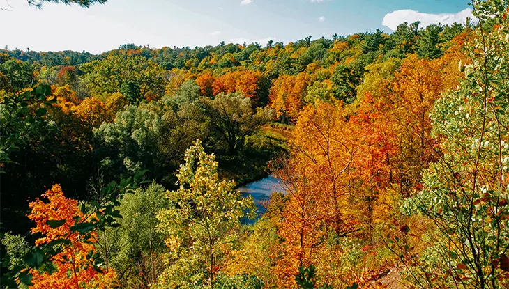
The Hamilton, Halton and Brant region along the eastern end of Lake Ontario is shaped by signature natural landscapes, including the Niagara Escarpment and river valleys.
For fall salmon watching, its rivers and tributaries provide key corridors where migrating fish move upstream, making the area a popular destination for observing salmon activity from suitable viewing spots.
Bronte Creek and Sixteen Mile Creek, Oakville
Oakville’s two creeks give salmon watchers a mix of parkland and quiet valley.
Bronte Creek has long drawn steelhead, brown trout and salmon, and Bronte Creek Provincial Park offers easy access by way of the Half Moon Valley Trail down to the water, where you can watch Chinook salmon in the fall alongside the park’s seasonal programming.
To the east, Sixteen Mile Creek runs through Lions Valley Park, a wooded ravine with trails that follow the water and viewpoints over the runs and pools.
Locations:
Bronte Creek Provincial Park, 1219 Burloak Drive, Oakville
Lions Valley Park, 1227 Lions Valley Park Road, Oakville
Red Hill Creek, Hamilton
In east Hamilton, Red Hill Creek runs through one of Ontario’s largest urban green spaces, linking the Niagara Escarpment to the Lake Ontario shoreline. Chinook salmon move up the creek from Hamilton Harbour each fall, and the Red Hill Valley Trail follows the water for seven kilometres from Albion Falls down through Kings Forest.
Sightings depend on rainfall and water levels, so time a visit for the days after a good rain for the best chance to see fish on the move.
Location: Red Hill Valley Trail, Mud Street, Hamilton
York, Durham and Headwaters
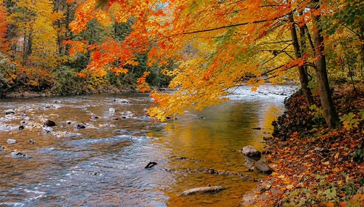
The regions of York, Durham and Headwaters, also known as Ontario’s central counties, stretch from the Greater Toronto Area’s inland areas toward the headwater reaches of the province’s river systems. In the fall, its rivers and tributaries can become important corridors for migrating salmon, offering visitors natural riverfront locations to watch fish activity.
Duffins Creek, Pickering and Ajax
Duffins Creek runs through Pickering and Ajax in Durham Region with several salmon viewpoints. The Seaton Hiking Trail leads to the Whitevale Dam near Whitevale Park, a natural gathering point where fish stack up below the barrier.
Downstream, the Greenwood Conservation Area offers wide trails and river access, while the Duffins Creek weir and walkbridge along the Trans Canada Trail put you directly over the water for one of the creek’s best views of the fall run.
Get tickets for the annual Salmon Walk at Greenwood Conservation Area held on September 27, 2026. Explore the headwaters of Duffins Creek Watershed on a guided nature walk.
Locations:
- Whitevale Park, 371 Whitevale Road, Pickering
- Greenwood Conservation Area, 2290 Greenwood Road, Ajax
Oshawa Creek, Oshawa
Oshawa Creek carries the fall salmon run right through the middle of the city.
The Joseph Kolodzie Oshawa Creek Bike Path follows the water for kilometres and links a string of green spaces where you can watch fish move upstream.
Stop at the Oshawa Valley Botanical Gardens for a short creekside walk framed by fall colour or visit the parks along the creek, such as Rotary Park and Storie Park, for quieter viewpoints away from the crowds.
Locations:
- Oshawa Valley Botanical Gardens, 155 Arena Street, Oshawa
- Rotary Park, 254 Centre Street South, Oshawa
- Storie Park, 111 Mill Street, Oshawa
Bowmanville Creek, Bowmanville
Bowmanville Creek offers one of the most family-friendly salmon viewpoints east of Toronto.
The Bowmanville Creek Trail is a wheelchair-accessible path that leads to a fish ladder where salmon make a series of jumps up the steps, giving patient watchers a close and repeated look at the climb. Autumn colour along the valley makes the short walk worthwhile on its own.
Location: 35 Roenigk Drive, Bowmanville
Huron, Perth, Waterloo and Wellington
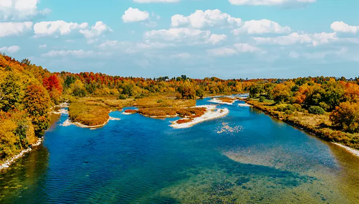
A mix of river valleys and tributary networks, from this region’s rural communities to the sandy Lake Huron shoreline, creates strong fall habitat for migrating fish. With waterways feeding into larger systems, this part of the province is well-suited for salmon watching, offering opportunities to observe salmon movement and activity along accessible river corridors.
Maitland River, Goderich
Near the Lake Huron town of Goderich, the Maitland River is best known for its big spring and fall runs of steelhead and salmon.
About 15 minutes southeast of downtown, the Falls Reserve Conservation Area sits on a wide, shallow stretch of the river dotted with low waterfalls, an easy setting to watch fish work upstream. Trails, family camping and picnic spots make it a relaxed base for a fall day by the water.
Location: 80900 Falls Reserve Line, Ashfield-Colborne-Wawanosh
Bruce, Grey and Simcoe
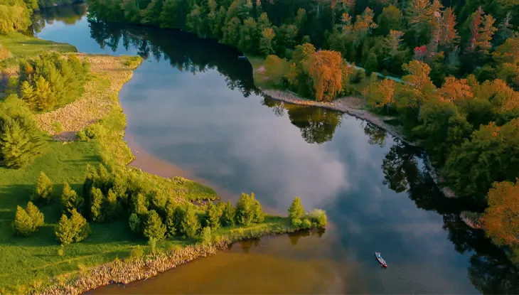
The Bruce, Grey and Simcoe region is threaded with rivers and connected watershed systems that create prime habitat for fall fish runs, making it especially worthwhile for salmon watching.
Silver Creek and Beaver River, The Blue Mountains
The Blue Mountains pair Georgian Bay scenery with a strong fall run.
The Thornbury Fishway, near the mouth of the Beaver River between Mill Street and Bruce Street, is a passive channel built for viewing, where rainbow trout and Chinook salmon are easy to see as they climb the pools.
Upstream, the Beaver River Trail through the Clendenan Conservation Area offers quieter looks at the migration. Along the Georgian Trail, pedestrian bridges over Silver Creek near Mountain Road and at Osler Bluff Road give two more reliable vantage points.
See the Salmon Run is an event organized by the Blue Mountain Watershed Trust Foundation on September 19, 2026. Hike along Pretty River, learn about fish migration and spawning and enjoy food and family-friendly activities.
Locations:
- Thornbury Fishway, 45 Bridge Street #9, Thornbury
- Clendenan Conservation Area, 10th Line, Clarksburg
Sydenham River, Owen Sound
Owen Sound is one of the few places in Ontario to watch salmon spawn in their natural habitat, and the self-guided Salmon Tour connects the best viewpoints along the Sydenham River. Start at the Owen Sound Mill Dam and Fish Ladder, the first fish ladder built in Ontario, where salmon leap a steep drop in the heart of downtown.
Follow the river to Harrison Park, which spans more than 40 hectares of trails and greenspace, then continue to the Inglis Falls Conservation Area, where the fish reach their upstream limit. Typically, a seasonal sanctuary closes the river to fishing during September.
Locations:
- Mill Dam, 601 2nd Avenue West, Owen Sound
- Harrison Park, 75 2nd Avenue East, Georgian Bluffs
- Inglis Falls Conservation Area, 237785 Inglis Falls Road, Owen Sound
Northeastern Ontario
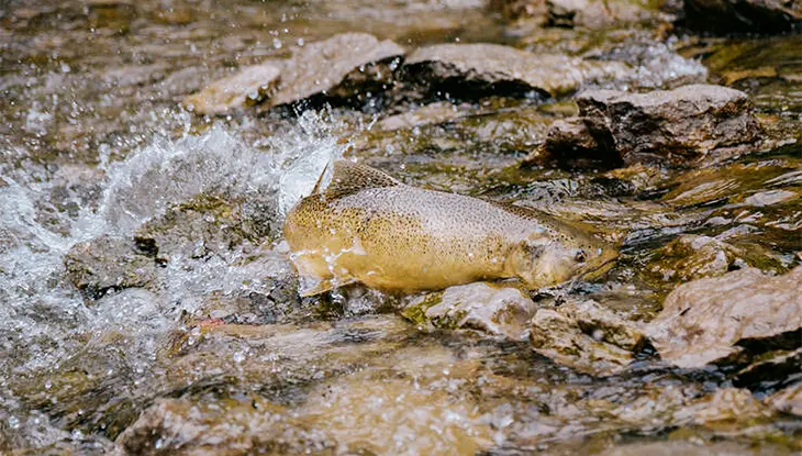
Located between Georgian Bay and Lake Huron, Manitoulin Island in Northeastern Ontario is recognized for being the world’s largest freshwater island. Its rugged shores, inland lakes and forested terrain create a scenic setting that draws visitors year-round for hiking and wildlife viewing.
Kagawong River, Manitoulin Island
On Manitoulin Island, the Kagawong River draws Chinook salmon up from Lake Huron’s North Channel to the base of Bridal Veil Falls, one of the island’s most-visited spots in Kagawong. A viewing platform from the parking lot off Highway 540 offers views of the pool, where the fish gather below the 11-metre falls.
Note that the Kagawong River Trail, which follows the river downstream past shallow cascades, is closed for the season due to erosion. Part of the river is a fall sanctuary, so give spawning fish room.
Location: Bridal Veil Falls, Billings
Witnessing the annual fish migration is just one of the many incredible natural spectacles in Ontario. For anglers looking to fish, the Ontario Fishing Regulations Summary provides all the information you need to get started.
Last updated: October 5, 2026