Find the best ATV trails in Ontario
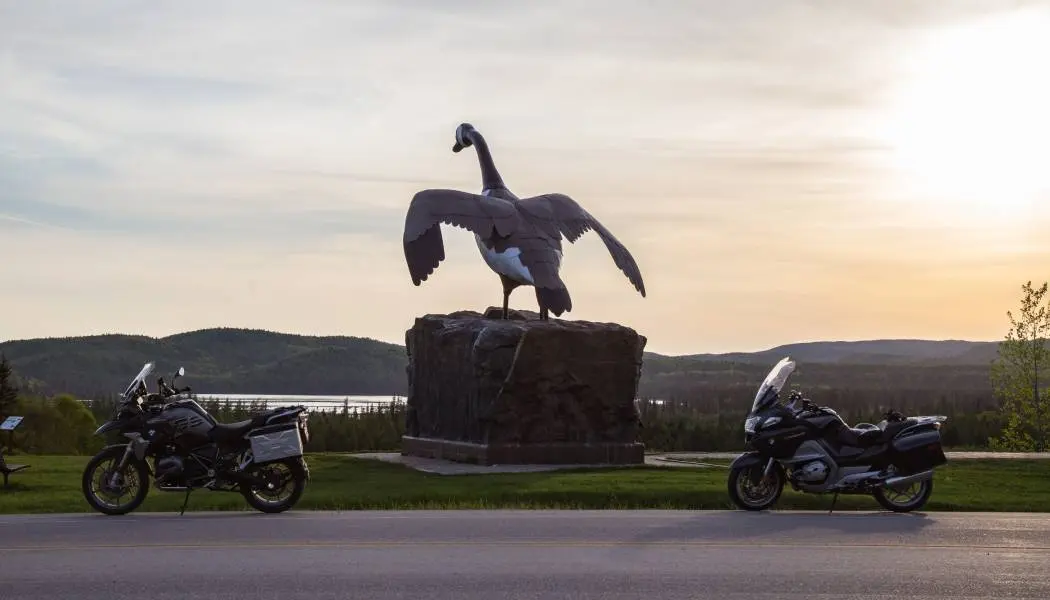
Kapuskasing | Virgil Knapp
Before you hit the trails, ATVs need to be registered and insured, and you’ll need a trail permit. Annual and short-term permits — including one-day and three-day options — can be purchased online or from a local club.
Two provincial organizations maintain trail networks across Ontario. The Ontario Federation of ATV Clubs (OFATV) manages nearly 10,000 kilometres of trail through 24 member clubs, all accessible with the QuadON Trail Permit.
The Eastern Ontario Trail Alliance (EOTA) manages multi-use trails from Lake Ontario north to Algonquin Park in eastern Ontario.
Find more trails across the province. Please note: Not all the trails listed here are approved Ontario ATV trails. Use at your own risk and check with local authorities before you head out.
Northeastern Ontario
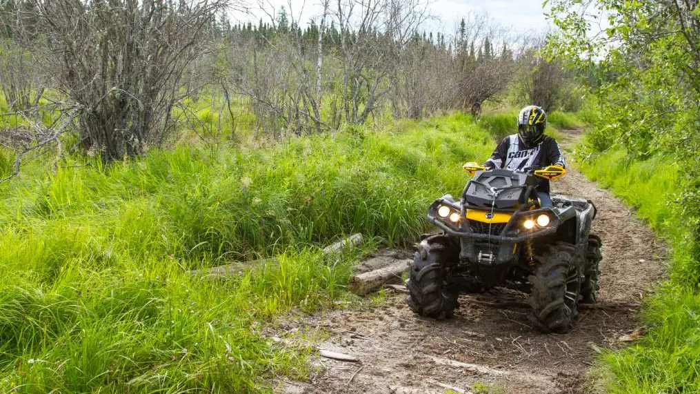
Northeastern Ontario is prime ATV territory, with vast Crown Land, rugged Canadian Shield terrain and rider-friendly communities that welcome ATVers from the trailhead right into town. Trails here range from leisurely forest meanders to challenging rock climbs, remote wilderness routes and guided off-road adventures deep in the boreal forest.
Voyageur Multi-Use Trails (VMUTS)
Distance: 300 kilometres
Rating: Novice to advanced
Pass/permit: OFATV or VMUTS
This trail system is nestled between two small mountain ranges — the Algonquin Highlands and the Laurentian Mountains — bordered by the Mattawa and Ottawa Rivers.
Riders will find a range of difficulty levels, from easy meandering trails through majestic pines and cool valleys with clear lakes and rivers, to challenging rock climbs and wet, muddy areas. With VMUTS as a member club of OFATV, your trail permit connects you to thousands of kilometres of trails across Ontario.
The Town of Mattawa and the surrounding townships have passed ATV-friendly bylaws, allowing riders to travel on local roads from their accommodations to the trailhead.
West Nipissing ATV Club Trails
Distance: Over 300 kilometres
Rating: Novice to advanced
Pass/permit: OnePass West Nipissing ATV Club membership
These trails are mainly situated between North Bay, Temagami and Chelmsford, with some stretching as far north and west as Shining Tree and Gogama.
Timmins ATV Club
Pass/permit: OFATV
Located in the heart of Northeastern Ontario, the Timmins ATV Club maintains trails in and around the city of Timmins, offering riders access to the region’s boreal forest and Canadian Shield terrain. As a member club of OFATV, a valid QuadON Trail Permit connects you to Ontario’s broader trail network.
Algonquin, Muskoka and Parry Sound
From the granite outcrops of the Canadian Shield to the lakes and forests of Muskoka, this region offers some of Ontario’s most scenic ATV riding. Trail systems range from family-friendly historic rail beds to challenging backcountry routes, with options for every skill level and riding style.
Park to Park Trails
Distance: 230 kilometres
Pass/permit: Park to Park Trail Association
The main system in the Parry Sound–Georgian Bay area is the Park to Park multi-use trail network. This exciting route from Killbear to Algonquin Park is set within a natural wilderness of lakes, forests, beaches and the 2.5-billion-year-old granite of the Canadian Shield.
The Park to Park trail system is made up of several named sections, each with its own character and terrain.
Seguin Trail
Distance: 80 kilometres
Rating: Moderate
The best-known section of the Park to Park trail network is the Seguin Trail. Following the historic route of the Ottawa, Arnprior and Parry Sound Railway (later part of the Canada Atlantic Railway) built by J.R. Booth, this section stretches from just west of Highway 400 to the Wall's Junction, where the trail splits. This part is one of the more adventurous segments, with a rough, dirt surfacing and the occasional puddle.
The best spot for parking is at the Georgian Bay Travel Centre, which has a large, paved lot with room for trailers and an off-road ramp connecting to the trail. Food and gas are available along the trail in Spruce Dale.
Old Bethune Trail
Distance: Approximately 35 kilometres
Rating: Moderate to advanced
This section continues from the Seguin Trail past Wall’s Split, passing under Highway 11 and through the town of Kearney to the Algonquin Park boundary. The trail features diverse terrain, from a retired railbed to roads and dirt tracks. The Old Bethune Trail is shared with the Algonquin West ATV Club and is managed by the Ontario Ministry of Natural Resources. Visit Algonquin West ATV Club on Facebook for more information.
Settler's Trail
Distance: Approximately 17 kilometres
Rating: Moderate
Settler’s Trail offers incredible views of Highway 11 and access to Huntsville when heading south, first on a dirt road and then on an off-road trail. Note that this is the end of the route for motorized users, as ATVs are currently not permitted on Muskoka roads.
Muskiig Trail
Distance: 15 kilometres
Rating: Moderate
Maintained by Carling Township, this rolling single-track style trail follows the original Shawnaga Colonization Road between Carling Station and the Dillon Road. Trailheads include small parking lots that can accommodate vehicles with trailers.
Guncotton Trail
Distance: 5 kilometres
Rating: Novice
From the trailheads at Nobel School just south of Avro Aero Blvd or McDougall Township office, head west on this gravel motorized (ATV and snowmobile) trail. This section is owned and maintained by the Township of McDougall.
Rose Point Trail
Distance: 8 kilometres
Rating: Novice to moderate
This trail follows the final segment of J.R. Booth’s railroad, connecting Rose Point to Forest Hill, adjacent to Oastler Provincial Park. The trail passes many wetlands, great for wildlife viewing. Cargill Road has a large parking area that fits over 20 vehicles, including trailers.
Lake of Bays ATV Club Trails
Distance: 90 kilometres
Rating: Beginner to advanced
Pass/permit: LBATV, HATVA, KATVA, Quad Niagara
The Lake of Bays ATV Association now operates over 90 kilometres of trails south of Dorset and Baysville that connect with the Haliburton trail system. Lake of Bays Township allow ATVs, UTVs, ORVs and SxS on all district and township roads. From May 1 until December 31, from sunrise to sunset, all roads in Lake of Bays Township may be used by all-terrain vehicles, subject to the Ontario Highway Traffic Act.
Follow Lake of Bays ATV Club Trails on Facebook for more information.
Baysville is your headquarters for all things off-road, with staging areas, fuel, food, trail maps and rentals all available from this welcoming community.
Algonquin West ATV Club
Distance: 450 kilometres
Rating: Novice to advanced
Pass/Permit: AWATV, HATVA, KATVA, Quad Niagara
This club is responsible for trails on the west side of Algonquin Park, from the north end of Muskoka north of Huntsville to well north and east of South River. Over 80% of the trails run deep in the bush, mainly on Crown Land. As an associate club to both the Haliburton ATV Club and the Kawartha ATV Club, membership gets you access to both trail systems.
Follow Algonquin West ATV Club on Facebook for more information.
Haliburton Highlands to the Ottawa Valley
Stretching from the scenic waterways of Haliburton County east through the Madawaska Highlands and into the Ottawa Valley, this region boasts some of Ontario’s most extensive and well-connected trail networks, covering everything from easy rail trails to extreme deep-woods paths.
Haliburton ATV Association
Distance: 1,700 kilometres
Rating: Novice to advanced
Pass/permit: HATVA, KATVA or Quad Niagara
The Haliburton ATV Association (HATVA) maintains trails throughout the beautiful and historic Haliburton County, renowned for its scenic landscapes and numerous waterways. The HATVA trail network connects with neighbouring trail systems in Kawartha, Muskoka, Peterborough and Madawaska, and includes a portion of the Haliburton Rail Trail from Kinmount north to Haliburton. Trail difficulty ranges from rail trails and forest access roads to extreme deep-woods paths that require winches as standard equipment. It is highly recommended that you tour with a club member who knows the trails or hire a local guide.
Several distinct trail systems make up the HATVA network, each offering a different character and terrain.
Haliburton Highlands Trail System
Distance: Over 500 kilometres
Rating: Intermediate to advanced
This intricate system throughout the Haliburton Highlands features trails ranging from intermediate to expert with Multiple staging areas and access points. It’s a vast array of trails and requires GPS navigation to explore without a guide.
Haliburton’s core trails run from Minden north to Algonquin Park, linking to the Madawaska, Muskoka, Five Points and Kawartha trail systems, with trails to Sherbourne Lake, Big Hawk Lake, Paul Lake, Tingey Lake, Shoe Lake, Livingstone Lake and Luck Lake.
Haliburton Rail Trail
Distance: 34 kilometres
Rating: Novice
Pass/permit: HATVA, KATVA, Quad Niagara
The Haliburton Rail Trail begins in Kinmount and runs north to Haliburton, maintained by the Haliburton ATV Club. The Kawartha ATV Club maintains the portion of the broader rail corridor south of Kinmount.
Hastings Heritage Trail
Distance: 156 kilometres
Rating: Novice
Pass/permit: OnePass EOTA, OFATV
The Hastings Heritage Trail is an all-season, multi-use recreational trail that follows an old railway line linking Hastings County. There are several parking lots and access points along the route. Hastings County trails consist of a 156-kilometre ribbon of land stretching from Glen Ross to Lake St. Peter, connecting them to the waterways of the Trent Canal System in the south and the edge of Algonquin Park in the north. With points of interest like waterfalls, ghost towns and the historic Hogan's Hotel, this is a great trail for a leisurely ride or a family outing.
Ottawa Valley ATV Club Trails (OVATVC)
Distance: 690 kilometres
Rating: Novice to advanced
Pass/permit: OFATV
The Ottawa Valley ATV Club’s riding area is nestled in the beautiful Madawaska Highlands of Eastern Ontario. The trails cover a large area bordered by Calabogie to the northeast, Sharbot Lake to the south, Bancroft to the west and the Madawaska River to the north.
Renfrew Country ATV Club Trails
Distance: 700 kilometres
Rating: Novice to advanced
Pass/permit: OFATV
Located in the Ottawa Valley, this massive network of trails is built on a foundation of abandoned rail lines and forest access roads that meander through forests, offer lake-view vistas, cross rural countryside and connect to rural communities that provide riders with convenient access to supplies and services.
Coe Hill Riders ATV Club
Rating: Novice to advanced
Pass/permit: OFATV
The Coe Hill Riders ATV Club is a member of the Ontario Federation of ATVs dedicated to supporting responsible recreational riding to North Hastings and North Kawartha.
Kawarthas and Northumberland
Kawartha ATV Association (KATVA)
The KATVA 600-kilometre trail system is approximately 1.5 hours from Toronto and has become a popular ATV hot spot. Members and day riders enjoy a multitude of dense forest tracts, natural vistas, historic stops, wildlife viewing and majestic outlooks. This trail system includes links to neighbouring Haliburton, Madawaska, Muskoka, Northumberland and Peterborough trail systems.
Several distinct trail systems make up the KATVA network.
Victoria Rail Trail Corridor (VRTC)
Distance: 84 kilometres
Rating: Novice
The Victoria Rail Trail Corridor links the communities of Bethany, Lindsay, Cameron, Fenelon Falls, Burnt River and Kinmount with multiple staging areas and access points. Owned and administered by the City of Kawartha Lakes and maintained by the Kawartha ATV Club, the trail extends north to Haliburton, where the Haliburton ATV Club takes over maintenance.
Somerville Forest Track
Distance: 33 kilometres
Rating: Novice to expert
Also known as The Pinery, this City of Kawartha Lakes multi-use trail comprises 3,420 hectares of mixed forest with a staging area and parking. Three loops offer something for every skill level: The Pinery (eight kilometres, beginners), the Millennium Trail (22 kilometres, intermediate) and the Marsh Trail (three kilometres, expert). This is a delicate area that requires the utmost respect from users.
Five Point System
Distance: over 150 kilometres
Rating: Intermediate to expert
Located north and east of Bobcaygeon with multiple staging areas and access points, the Five Points System was developed by the Twin Mountains Snowmobile Club and Buckhorn District Snowmobile Club. Make sure you have proper GPS mapping and orientation experience before heading out and refer to KATVA maps for navigation.
Ganaraska Forest
Distance: 300 kilometres
Rating: Novice
Pass/permit: Ganaraska Forest Membership or day pass
Just an hour’s drive from Toronto, Southern Ontario’s largest forest features hundreds of kilometres of trails and logging roads with easy parking and multiple entry points. ATVing is permitted in the West Forest and East Forest only — the Central section is a passive-use area.
Peterborough County Trails ATV Club (PTBO Trails)
Rating: Novice to advanced
Pass/permit: EOTA
Formerly the Havelock and District ATV Club, the PTBO welcomes riders of all skill levels—from brand new to experienced—on both ATVs and Side by Sides to experience the beautiful destinations in Peterborough County.
Algoma Country
Algoma Country is home to some of Ontario’s most spectacular and unspoiled ATV terrain. Ancient rock escarpments, racing rivers and vast transition forests create a dramatic backdrop for riding adventures ranging from relaxed day trips to multi-day wilderness excursions.
ATV Elliot Lake
Distance: 300+ kilometres
Rating: Novice to advanced
Pass/permit: OFATV
The Elliot Lake area in Algoma Country is home to trails carved through ancient rock escarpments, racing rivers and transition forests.
Well-planned trails are looped, so you’re never far from the city’s amenities — perfect for day trips, overnight stays or extended three- to five-day excursions. For more information, contact the Elliot Lake ATV Club on Facebook.
Several distinct trails make up the Elliot Lake network, each with its own terrain and character.
The Boardwalk Run
Distance: 41 kilometres
Rating: Easy/moderate
Pass/permit: OFATV
The club's first trail includes a variety of terrain with scenic views across Home Lake and Scenic Lake. Wrapping around the city, the main loop connects with the Boreal Forest Run and the Portage Run. Most of it is easy to moderate, with short and avoidable portions that require riders with more experience.
Boreal Forest Run
Distance: 47 kilometres
Rating: Easy to moderate
Pass/permit: OFATV
Expansive views along this open powerline trail make it a favourite for ATV riders and snowmobilers alike. The trail leads to an old-growth forest full of wildflowers in summer and vivid yellows from birch trees in fall.
May Lake Loop
Distance: 60 kilometres
Rating: Moderate
Pass/permit: OFATV
The first — and possibly only — trail in Ontario built by an ATV club for shared use with snowmobiles is incredibly scenic, with a backdrop of rock cliffs, bridges over remote lakes and great city views. The trail can be extended to Whiskey Lake for a real adventure.
Portage Run
Distance: 49 kilometres
Rating: Advanced
Pass/permit: OFATV
This looped trail is renowned as a challenging ride through rough, muddy and rocky sections, recommended for advanced riders with four-wheel-drive ATVs. An extension of the Boreal Forest Run or Boardwalk Run, the route provides a fantastic view of Lake Matinenda and passes through tight, muddy trails and along great sections above Quimby Lake.
Horne Lake Trail
Distance: 6 kilometres
Rating: Novice
Pass/permit: OFATV
Just outside Elliot Lake, this multi-use trail offers more spectacular views of the surrounding wilderness.
Bruce, Grey and Simcoe
The rolling terrain of Bruce, Grey and Simcoe counties offers ATV riders a mix of forest trails, rail corridors and open farmland, with access to Georgian Bay and some of Ontario’s most scenic countryside. This region is also home to the Quad Counties Loop, Ontario’s newest signature multi-day ATV route.
Quad Counties Loop
Distance: 200+ kilometres
Rating: Novice to advanced
Pass/permit: OFATV
The Quad Counties Loop is OFATV’s signature multi-day route, linking four member clubs across Simcoe, Grey, Bruce and Wellington counties into more than 200 kilometres of continuous, signed and maintained trail.
The loop mixes wide forest corridors, rolling farm country and hidden backwoods connectors, and every section is mapped in the QuadON App — OFATV’s official trail-navigation app for permit holders. Staging areas with parking for trucks and trailers can be found at several trailheads, and fuel, food and services are available in towns throughout the route, making it easy to plan a single-day ride or a multi-day trip.
Baxter/Severn ATV Trail Riders
Distance: 90 kilometres
Pass/permit: OFATV
These trails are just east of Georgian Bay and include a great loop from Baxter Lake alongside many lakes of the area south to Coldwater and back north to Port Severn. Expect mudholes, water and technical rocks around Barron's Lake.
Central Ontario ATV Club Trails
Distance: 157 kilometres
Rating: Novice to advanced
Pass/permit: OFATV
This club maintains four loops south and east of Georgian Bay, with scenery varying from smooth and sandy to tricky and technical. Navigate the full network using the COATV Interactive Trail Map.
Dufferin Grey ATV Club Trails
Distance: 267 kilometres
Pass/permit: OFATV
Most of these trails are in Grey County, with some stretching down into Dufferin County near Shelburne.
Huron Shores ATV Club Trails
Distance: over 100 kilometres
Pass/permit: HSATV
This network of trails is shared with hikers, horses and snowmobilers, and connects to neighbouring clubs including the West Grey ATV Club and the Dufferin Grey ATV Club. The speed limit throughout is 50 kilometres per hour.
Follow Huron Shores ATV Club Trails on Facebook for more information.
West Grey ATV Club Trail
Pass/permit: OFATV
The West Grey ATV Club connects riders to neighbouring trail systems, including the Dufferin Grey ATV Club, Huron Shores ATV Club and South Bruce Peninsula ATV Club.
Follow West Grey ATV Club Trail on Facebook for more information.
South Bruce Peninsula ATV Club
Pass/permit: EOTA
Located on the Bruce Peninsula, the South Bruce Peninsula ATV Club maintains trails winding through limestone outcrops, mixed forest and rural countryside. As a member club of OFATV, a valid QuadON Trail Permit connects riders here to a broader provincial network through neighbouring clubs.
Ottawa Region
East of Ottawa, a network of ATV trails winds through rolling countryside, farmland and forest along the Quebec border, offering riders a quieter, rural alternative with access to the broader OFATV trail system.
ATV Club of Eastern Ontario Trails (ATVCEO)
Distance: 329 kilometres
Rating: Novice to advanced
Pass/permit: OFATV
ATVCEO maintains a series of trails in the countryside east of Ottawa, from just east of Casselman to Alexandria and north to the Ottawa River, linked to the Nation Valley ATV Club trails.
Southeastern Ontario
From the banks of the St. Lawrence River to the farmlands south of Ottawa, Southeastern Ontario’s ATV trail network connects rural communities and scenic landscapes through an expanding system of maintained trails, with options for riders of every skill level.
Johnstown ATV Club Trails
Distance: 275 kilometres
Rating: Intermediate to advanced
Pass/permit: OFATV
View a map of the trails and locations to buy passes on the Johnstown ATV Club website.
Nation Valley ATV Club Trails (NVATC)
Distance: 233 kilometres
Rating: Novice to intermediate
Pass/permit: OFATV
The Nation Valley ATV Club maintains trails just south of Ottawa and further south near Winchester, Hallville and South Mountain, and hosts events throughout the year.
Napanee and District ATV Club Tails
Rating: Novice to advanced
Pass/permit: OnePass (EOTA or Park to Park), Napanee & District ATV Club
Located in the Lennox and Addington area, this club is a partner with access to the massive 2,000-kilometres of Eastern Ontario Trails Association trails.
Rideau Lakes ATV Club
Rating: Novice to intermediate
Pass/permit: OFATV
Founded in 2015, the Rideau Lakes ATV Club is in Rideau Lakes Township, southwest of Smiths Falls. Recent developments connect the trails to the Thousand Islands ATV Club, opening up more trails to ride.
Thousand Islands ATV Club
Distance: 126 kilometres
Rating: Beginner to intermediate
Pass/permit: OFATV
Most of this trail system is designed for beginner-to-intermediate riders, though there are a few challenging points with bypasses available.
Glendaler's Winter Sports Club Trails
Distance: 200 kilometres
Rating: Novice to advanced
Located in the Seaway Valley, these trails stretch from Cornwall to the Quebec border in the east and south from the shores of the St. Lawrence River up to Alexandria. Winter trails are open from mid-December to mid-March each year, while the Peanut Trail is open year-round. It runs on the former CP Rail bed, which is now owned by South Glengarry Township.
Huron, Perth, Waterloo and Wellington
The agricultural heartland of Southwestern Ontario may surprise ATV riders with its network of trails winding through varied terrain. The Great Lakes ATV Club operates two separate trail systems in this region — note that you will need to trailer between them, as they are approximately 23 kilometres apart.
Great Lakes ATV Club Trails
Pass/permit: OFATV
Rating: Beginner to intermediate
The Great Lakes ATV Club is home to two separate trail systems, with directions posted at each parking area.
Innerkip Trail
Distance: 10 kilometres
Rating: Moderate
This system consists of winding flat trails, some hilly areas and Blue Arrow trails with challenging muddy sections. It takes about 1.5 to 3 hours to run and is side-by-side friendly (up to 64" width). This system is generally open for winter riding.
Hamilton, Halton and Brant
Just a short drive from the Greater Toronto Area, the Hamilton, Halton and Brant region offers accessible ATV riding through wooded terrain and open countryside, also via the Great Lakes ATV Club.
Great Lakes ATV Club Trails
Rating: Beginner to intermediate
Pass/permit: OFATV
The Great Lakes ATV Club’s trail in this region centres on the Cathcart Trail, a family-friendly system in the Brantford area.
Cathcart Trail
Distance: 12 kilometres
Rating: Beginner to intermediate
This family-friendly trail system with some blue-arrow sections takes about 1.5 to three hours to run. Note the signs carefully, as a few trails are one-way only. The trail is not side-by-side friendly.
Niagara Region
Ontario’s southernmost ATV riding takes place in the Niagara Region, where riders can legally explore private property, Crown Land and the designated Quad Niagara trail system.
Quad Niagara ATV Club Trails
In the Niagara Region, you can legally ride your ATV on your own property, private property with permission from the landowner, Crown Land and on the Quad Niagara trail system.
Follow Quad Niagara ATV Club Trails on Facebook for more information.
York, Durham and Headwaters
For riders based in or near the Greater Toronto Area, the York, Durham and Headwaters region provides convenient access to ATV trails through the Dufferin Grey ATV Club, whose trails extend into the rolling hills of Grey and Dufferin counties
Dufferin Grey ATV Club Trails
Distance: 267 kilometres
Pass/permit: OFATV
Although most of these trails are in Grey County, some stretch down into Dufferin County near Shelburne.
Southwestern Ontario
Southwestern Ontario’s ATV trails offer riders a mix of Carolinian forest, agricultural land and scenic countryside, with clubs across the region maintaining trail networks and working to expand their systems through collaboration with local landowners.
Essex County ATV Club
Pass/permit: OFATV
The Essex County ATV Club maintains the Walker Trail and the Howard Trail.
Talbot Trail ATV Club Trails (TTATV)
Distance: 100 kilometres
Rating: Novice to advanced
Pass/permit: TTATV
The Talbot Trail ATV Club maintains several trails throughout the St. Thomas, Port Stanley, Aylmer and surrounding area, offering riding for beginners, intermediate and advanced riders. The club is currently working with landowners to develop additional sanctioned trails.
From Northeastern Ontario’s rugged Canadian Shield to the scenic rail trails of the Kawarthas and the multi-day adventures of the Ottawa Valley, Ontario’s ATV trail network has something for every rider. Gear up, grab your trail permit and get out there — thousands of kilometres of trail are waiting to be explored.
Last updated: July 3, 2026