Stroll Ontario’s scenic boardwalk trails
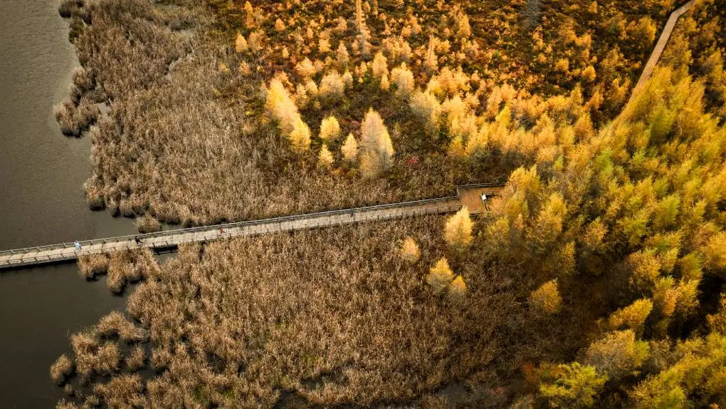
Mer Bleue | Ottawa Tourism
Boardwalks protect significant landscapes by guiding hikers through sensitive ecosystems in parks, conservation areas and at beaches. Throughout the province, in towns and cities, boardwalks allow visitors and locals to access waterfronts and enjoy the timeless activity of strolling. In the fall season, Ontario’s boardwalk trails are especially scenic.
Here are some beautiful boardwalk trails in a variety of settings, inviting you to enjoy a walk.
Southwestern Ontario
Point Pelee National Park Marsh Boardwalk
Point Pelee covers the narrow peninsula jutting out into Lake Erie just south of Leamington in Southwestern Ontario and is Canada’s most ecologically diverse national park. The park consists of marshland, forest and sandy beaches with well-maintained hiking, paddling and cycling trails. The one-kilometre boardwalk trail loops through the inland marsh with lookout spots and telescopes to view birds and other wildlife.
Admission fees and operating hours apply; parking is available at the entrance and facilities include a visitor centre and washrooms.
Location: 1118 Point Pelee Drive, Leamington
Sifton Bog Trail
Uniquely situated within the city limits of one of southern Ontario’s largest cities, this park is home to ecologically significant wetlands. Notably, it’s one of the southernmost floating acidic peat bogs with boreal plant life in Canada. The single-track trail includes portions of beautiful wooden boardwalk that lead out to Redmond’s Pond and feature interpretive signage. Look out for birds and other wildlife along the way.
Parking is available at the Oxford Street entrance.
Location: 1210 Oxford Street West, London (between Hyde Park Road and Oxford Street)
St. Thomas Elevated Park
Known as Railway City, St. Thomas once served as a major passenger and freight train hub. The community embraces its rail heritage, most recently with the transformation of a historic trestle bridge into Canada’s first elevated park. Walk along the original wooden railway planks and take in arts, gardens and sweeping panoramic views.
Location: 1 Centre Street, St. Thomas (across from King and Centre Streets)
Niagara Region
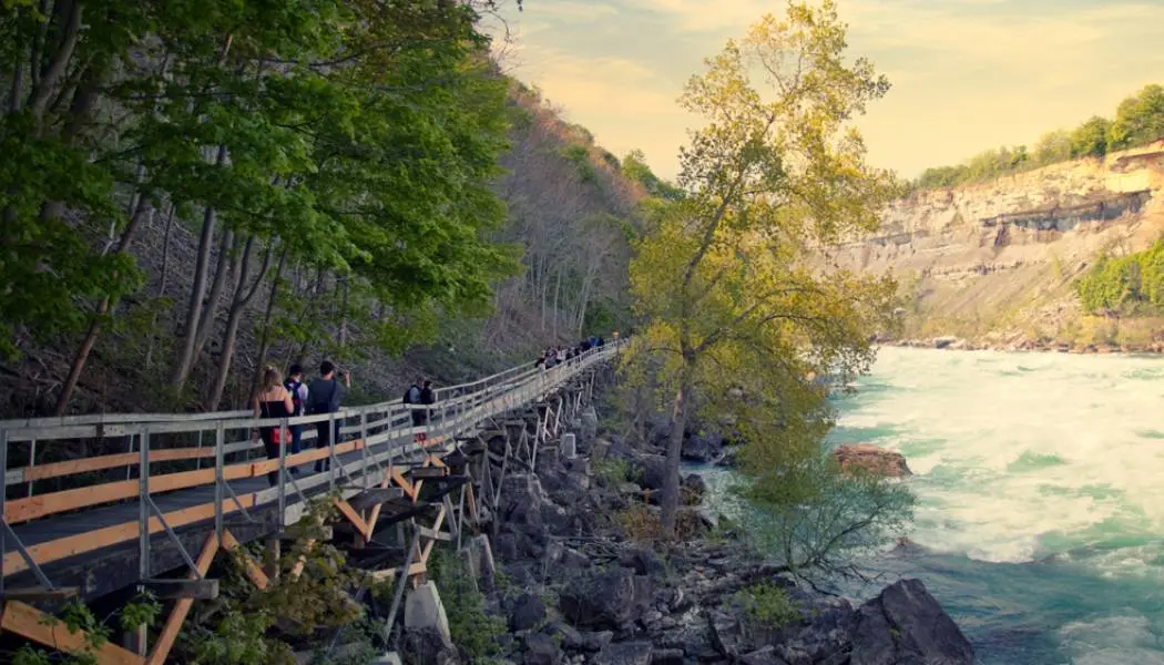
Niagara’s White Water Walk
One of Niagara Parks’ most exciting attractions, this 400-metre walkway hugs the edge of the raging Class 6 white water rapids section of the Niagara River at the base of the world-famous Niagara Falls. To reach the boardwalk, visitors ride an elevator approximately 70 metres down into the Niagara Gorge and pass through a short tunnel.
Enjoy the spectacle from several viewing platforms. Nearby attractions include the Whirlpool Aero Car and Journey Behind the Falls.
The walkway operates seasonally from April to early November.
Location: 4330 River Road, Niagara Falls
Hamilton, Halton and Brant
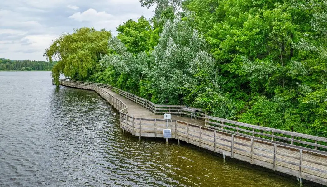
Kelso Conservation Area
Part of Conservation Hamilton, Kelso is a year-round recreational playground for outdoor enthusiasts and nature lovers. In the winter, the park transforms into a popular ski and snowboard destination. During the rest of the year, hikers and mountain bikers explore the vast network of trails, including a portion of scenic lakeside boardwalk.
Location: 5234 Kelso Road, Milton
Burlington Waterfront
Perched on the shores of Lake Ontario, the town of Burlington has an inviting and beautiful waterfront core that features a popular promenade path along Spencer Smith Park that leads to Brant Street Pier. Enjoy seasonal gardens, playgrounds, picnics and easy access to the Art Gallery of Burlington, the Burlington Performing Arts Centre and other key downtown attractions.
This walkway is part of the Great Lakes Waterfront Trail, an extensive trail system that reaches over 3,600 kilometres connecting over 150 communities along the Great Lakes shoreline.
Meter parking is available at the Spencer Smith parking lot.
Location: 1400 Lakeshore Road, Burlington
Greater Toronto Area
Toronto Beaches Boardwalk
The eastern boardwalk extends three and a half kilometres along the sandy shoreline of Lake Ontario in Toronto’s east-end Beaches neighbourhood. It runs parallel to the mixed-use Martin Goodman Trail and features benches facing the lake, gardens, public facilities and seasonal refreshment stands along the way.
You’ll want to linger on the beach, enjoy people-watching and take in the scenic lake views as you stroll this pretty pathway. The relaxed, beachy vibe extends through the neighbourhood to the shops, cafes and restaurants along Queen Street East.
In addition to some free street parking, very limited parking is available at Balmy Beach Lot and at the bottom of Woodbine Avenue. Consider taking transit (the 501 Queen Street streetcar or the Woodbine 92 and Main 64 bus routes are convenient ways to get to the beach boardwalk).
Bruce, Grey and Simcoe
Singing Sands Interpretive Trail in Tobermory
Part of the popular Bruce Peninsula National Park, Singing Sands is a beach attraction on Lake Huron, west of Highway 6 and about 10 kilometres south of Tobermory. The beach leads to inviting shallow waters and is surrounded by rare sand dunes and unique plant life, including orchids. The Interpretive Trail winds through forest and along the sand dunes and features a stretch of boardwalk. Consider visiting during the week or in the spring or fall, as this location gets busy in the summer.
Bonus boardwalks! Cyprus Lake Trail within the park also features a wooden boardwalk section. And in the town of Tobermory, a scenic boardwalk connects Little Tub Harbour to the Bruce Trail terminus cairn via Bay Street.
Day-use and parking fees apply; limited parking is available on a first-come-first-serve basis.
Location: Dorcas Bay Road, Tobermory
Kawarthas and Northumberland
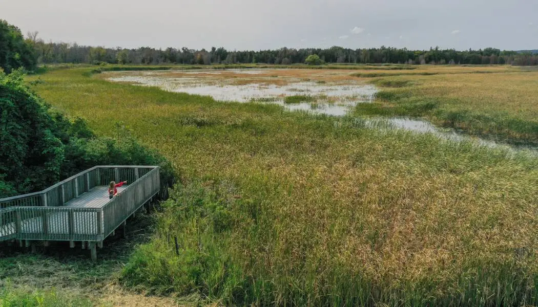
Presqu’ile Provincial Park
In the picturesque county of Northumberland, the Marsh Boardwalk Trail loop in Presqu’ile Park is particularly pretty. Popular with birders, it extends approximately 800 metres of the boardwalk across a vast marsh and features viewing towers and lookout platforms.
Location: 328 Presqu'Ile Parkway, Brighton
Ottawa Region
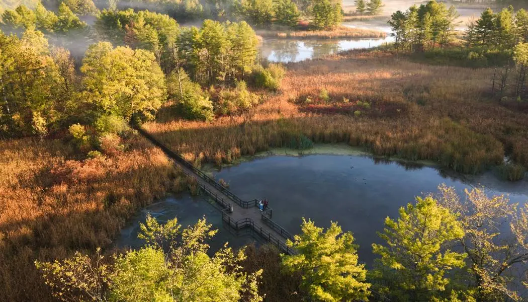
Mer Bleue Bog Trail near Ottawa
Approximately 18 kilometres east of Ottawa’s downtown, Mer Bleue Conservation Area covers approximately 3,500 hectares of significant northern boreal landscape that’s home to a diverse and ancient ecosystem of flora and fauna. Follow the Interpretive Boardwalk Trail through the forest, keeping an eye out for turtles, herons and other wildlife.
Free parking and public washrooms are available; dogs are not permitted on the trail.
Location: Ridge Road, Ottawa
Southeastern Ontario
Little Cataraqui Creek Conservation Area
Just north of downtown Kingston, this diverse recreation and conservation area covers almost 400 hectares of marsh, field and forest habitat. There are picturesque boardwalk sections along the trails crossing marshy areas, including near the Outdoor Centre.
The conservation area operates during daylight hours and admission fees apply.
Location: 1641 Perth Road, Glenburnie
Algonquin Park, Muskoka and Parry Sound
Hunter’s Bay Trail in Huntsville
With water on both sides, the 500-metre floating boardwalk section of Hunter’s Bay Trail is stunning in every season, especially in fall when the trees are at peak colour. The full, multi-use trail extends almost five kilometres through the community of Huntsville in Muskoka and is part of the Trans Canada Trail. It follows the south banks of the Muskoka River waterway between Lake Vernon and Fairy Lake past Avery Beach Park and Orchard Park.
A parking lot is located at the Centre Street trailhead.
Location: 42 Centre Street North, Huntsville
Northeastern Ontario
Providence Bay Boardwalk
Located on the southern shores of Manitoulin Island, the beach community of Providence Bay is a nature lover’s delight. The two-kilometre boardwalk is a local highlight.
The boardwalk provides stunning views of Lake Huron and breathtaking sunsets. It also helps preserve the precious ecosystem and the sensitive sand dunes formed thousands of years ago.
Linger at nearby picnic tables, dip in the clear, pristine water on warm days and enjoy peaceful nature walks and vibrant foliage in the fall. The area is also perfect for bird watching and nature photography.
The boardwalk is wheelchair accessible. Parking is available at the Harbour Centre and Town Square.
Location: Mutchmor Street, Central Manitoulin
Sudbury’s Bell Park Boardwalk
Bell Park is a large and scenic waterfront oasis in downtown Sudbury. This popular spot features beaches, gazebos, a playground, an amphitheatre and seasonal events and amenities.
Stroll along the two-kilometre boardwalk that hugs the shoreline of Ramsey Lake from Science North to the Bell Park Flower Garden. During the summer and autumn months, enjoy a picnic or peruse the Sudbury Market.
Free parking is available in lots at 506 Elizabeth Street and 100 Ramsey Lake Road or travel by transit with the GOVA bus service on Route 1 Main Line.
Location: Paris Street, Sudbury
North Bay Waterfront Walkway
Over three kilometres of walkway extends along the edge of Lake Nipissing in downtown North Bay with excellent views over the water. You may even spot the mysterious Manitou Islands.
Features along the popular stretch include plants, trees and ornamental grass in the arboretum, a playground and heritage mini-train and carousel for kids to play on, picnic shelters and the famous Chief Commanda II home dock. The paved surface makes the path accessible for wheelchairs and strollers.
Parking is available at Lakefront View along Memorial Drive.
Location: Memorial Drive, North Bay
Sault Ste. Marie and Algoma
Sault Ste. Marie Waterfront Walkway
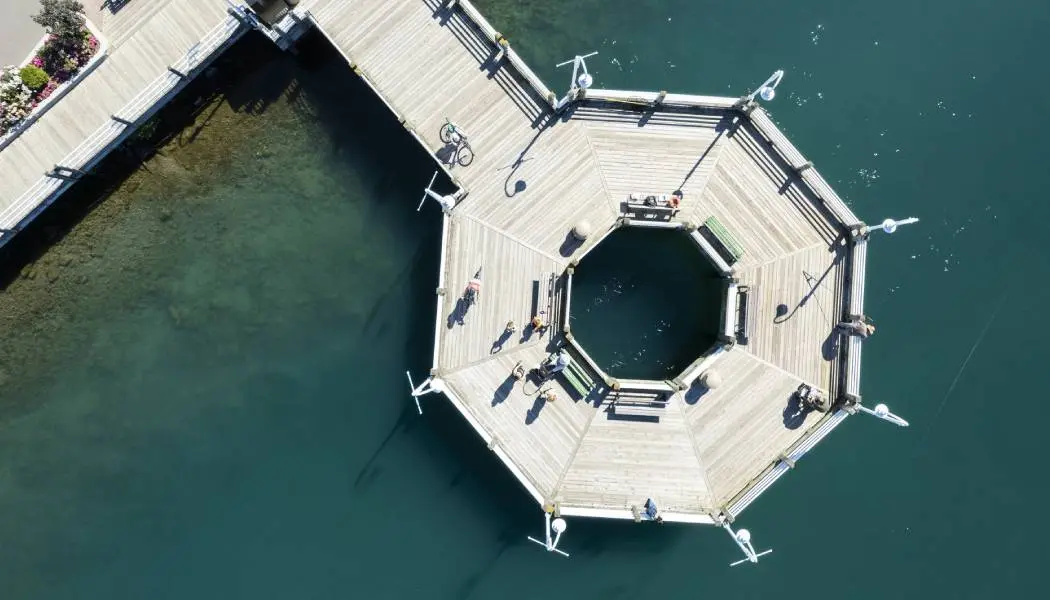
Following alongside the St. Mary’s River, the Sault Ste. Marie Waterfront Walkway stretches over two and half kilometres between Canal Drive and the Art Gallery of Algoma in downtown Sault Ste. Marie. Watch marine traffic navigate locks along the river and take in views of the International Bridge, Whitefish Island and even the US shoreline in Michigan State.
The boardwalk features benches, picnic tables and lookout platforms and is connected to the longer multi-use Hub Trail that circles the city, as well as several attractions like Roberta Bondar Park, Ermatinger-Clergue Historic Site and the Canadian Bushplane Museum.
Meter parking is available downtown or in the Station Mall parking lot at 293 Bay Street.
Location: 5V4 Hub Trail, St. Marys River Drive, Sault Ste. Marie
Whitefish Island
Whitefish Island is a long teardrop-shaped island located south of downtown Sault Ste. Marie. This national historic site is accessible by crossing the locks from the Sault Ste Marie Canal. It is home to a variety of plants and wildlife and makes the perfect city retreat.
Explore the walking trails and rustic boardwalk paths, enjoy the stunning views of the St. Mary’s River and learn about the Indigenous heritage of Whitefish Island.
Location: Whitefish Island
Whether you’re hiking a wooden pathway through the forest or taking a leisurely walk along an urban waterfront promenade, Ontario’s diverse boardwalks have one thing in common: they are undeniably scenic, so bring your camera.
Last updated: September 2, 2026